
|
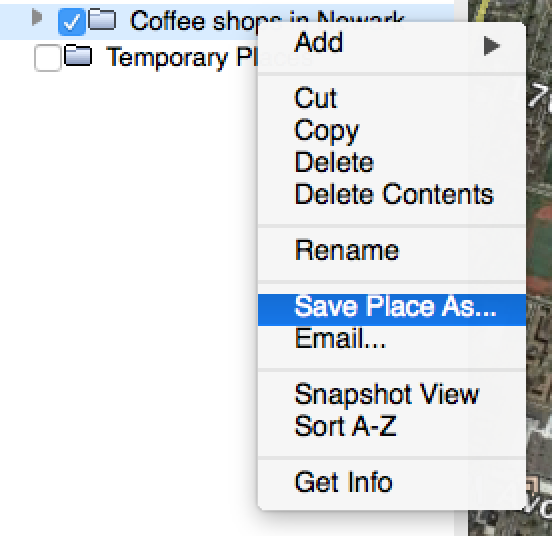
Risk Terrain Modeling (RTM) analyzes crime patterns to identifies features in the environment that attract criminals and enable their illegal behavior. (RTM is also used for other types of events and human behaviors, but that's a discussion for another blog post). The RTM diagnosis makes very accurate forecasts of places where resources get deployed in order to intervene -- to reduce risk and prevent crime. Many physical features make up a landscape, and the way they co-locate or interact in space can influence behaviors, events and outcomes. Here is a starter list of environmental features that could be considered for testing with RTM, such as fast food takeout, convenience stores, rooming houses, coffee shops, schools, alleyways, and so forth. There are many sources to get these datasets, including your own/agency CAD/RMS systems, open data portals, local government records, or business directories. We want to share another option: Google Earth Pro. In Google Earth, you can search for place features and then export the feature points as KMZ files. Then you can easily use the KMZ files for Risk Terrain Modeling in the RTMDx software. Check this out (5 steps): 1. Search for the places (i.e., risk factors) of interest. E.g. "Coffee Shops in Newark" 2. A list appears and the points appear on the map. 3. Click the small folder icon to "Copy the current search results to My Places" 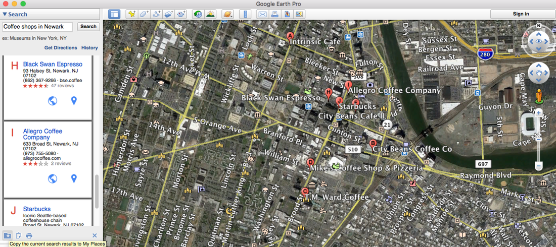 4. In Google Earth, with the search results map layer in your My Places table of contents, simply right-click on the layer and select "Save Place As..."
5. Open the RTMDx software and click the "Upload Files" button to add your newly acquired risk factors in KMZ format. Then run your RTM analysis. 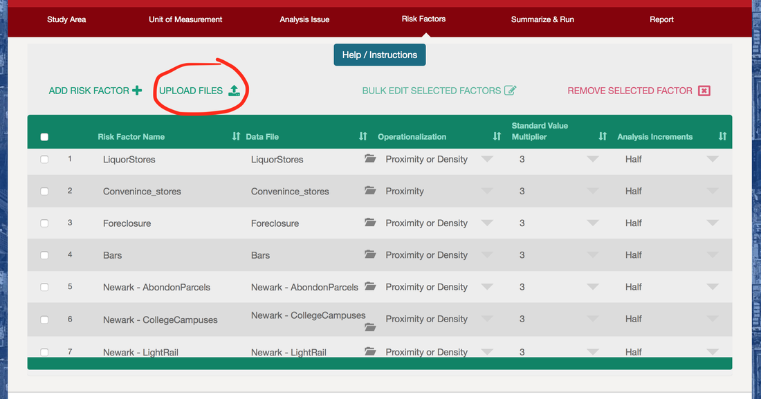 |
 RSS Feed
|
|
The official website of Risk Terrain Modeling (RTM) research and resources, based out of Rutgers, The State University of New Jersey.
|